|
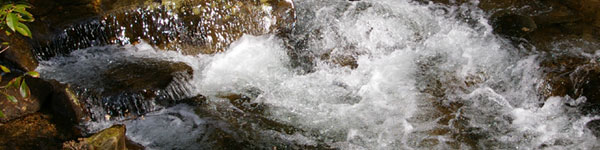
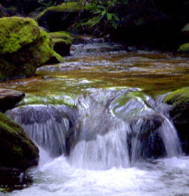
Close your eyes, listen to the flowing water, and enjoy the peace that comes within you. Most waterfalls are in the north Georgia mountains. Click on links below for more information, pictures, videos and directions to these scenic waterfalls. |
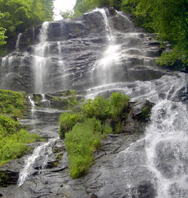
Amicalola Falls Waterfalls - Located in Amicalola State Park, these falls plunge 729 feet in seven cascades. Designated as on of the seven wonders of Georgia, Amicalola is the highest waterfall east of the Mississippi River. Click on link above for video, map, pictures and more.  |
| Ammons Creek Falls and Holcomb Creek Falls - Located on Holcomb Creek on the trail of the same name, this picturesque waterfall drops and shoals for about 150 feet. Hike difficulty to this waterfall is moderate.
|
| Angel Falls and Angel-Panther Falls - These falls are about 50 feet high. Another set of falls is about 1/2 mile upstream. |
|
| Anna Ruby Falls - This spectacular double falls was created by the junction of Curtis and York Creeks, both coming off Tray Mountain from underground springs. Curtis Falls drops 153 feet, and York about 50 feet. Click on link above for video, pictures and more. |
| Becky Branch Falls - This waterfall is located in a dense forest, in part of the beautiful Warwoman Dell area, just outside of Clayton. Martin Creek Falls - This two-tier waterfall is 35 feet high with aquatic plants covering the weeping rock wall on the left. This 20-minute walk (.5 mile) follow the Bartram Trail along the west side of the creek. |
|
| Blood Mountain Falls - This splendid waterfall is located on the Blood Mountain Stream. The stream flows approximately 20 feet through a rock cut, creating a churning sluice of water. An unmaintained path leads to the falls. Directions: Start at the intersection of US 19/129 (Turners Corner). Go west on US 19 for approximately 1/2 mile. Turn right and travel up Dicks Creek Road. The road soon narrows. Go 2 1/4 miles to the Blood Mountain Stream. The falls are located on the right. |
| DeSoto Falls - There are five beautiful falls along the 3 mile section of the DeSoto Falls Trail located in the 650-acre recreation area. Three of these falls are maintained for the Hiker's viewing convenience, and are designated as the lower, middle and upper DeSoto Falls. The lower falls cascades 20 feet, the middle falls about 80 feet, and the upper falls about 200 feet. Click on link above for video, pictures and more. |
| Dick's Creek Falls - This waterfall is about 60 feet high and makes a sheer drop over a granet mound into the Chattooga River. |
|
| Dukes Creek Falls - These stunning falls drop about 150 feet down sheer granite canyon and into Dukes Creek. A well-designed trail switches its way into Dukes Creek Gorge, ending at the base of the falls. Click on link above for video, pictures and more. |
Estatoah Falls -Estatoah Falls is a large, open waterfall that may be viewed from the highway.
Directions: It is about 1/2 mile beyond Dillard Georgia. Turn right on Highlands/Sky Valley Road (GA 246). Start looking for the falls on the right after 1 mile. There is a pull-out vantage point near the falls about 1 mile up the mountain. |
|
Helton Creek Falls - 2 waterfalls, 1 small and 1 large, are located on Helton Creek.
Directions: Go to Helton Creek Road and Forest Service Road 118, just 1 1/2 miles north of Neel's Gap off Highway 19/129. The road is on the right as you travel north. It is just south of Vogel State Park. You have only .2 mile trail leading from the parking area on Helton Creek Road, to the base of the larger upper falls. |
| Hemlock Falls - The scenic two-mile trail leading to Hemlock Falls teases visitors with the sounds of rushing water during the entire hike. |
|
| High Shoals Falls - Two very impressive waterfalls along High Shoals Creek grace this 170 acre scenic area. the falls are reached by land 2/10th mile trail that provides viewing platforms at each of the falls. The estimated drop is 300 feet. Directions: Go to Georgia Hwys 17/75 N from Helen Georgia for 11.4 miles, or south from Hiawassee for about 9 miles to Forest Service Rd 283, which is on the east side of the highway. |
| Horse Trough Falls - The Horse Trough Falls Trail (.4 mile in length) is an excellent trail for novice hikers. This waterfall is inside the Horse Trough Park campsite. Directions: Take GA 75 north from Helen Georgia for eight miles to Unicoi Gap. Turn left onto Forest Service Road 44 (Wilkes Creek Road). Go 5.4 miles to a sharp curve, and take the right fork. Go 0.2 mile, toward the stream and follow colored blazes on the trees. |
| Mill Creek Falls - The waterfall on Ground Hog Branch drops about 150 feet where it combines with the main Mill Creek. The combined streams plunge another estimated 150 feet, ending in a series of rapids which cascade down the Mill Creek Gorge. Directions: From Hiawassee Georgia, take U.S. 76 east. Turn right on GA Hwy. 75 and travel 3.5 miles. Turn left on Mill Creek Road (Forest Service Road 26) for 2.5 miles. The road crosses Mill Creek 1.5 miles from pavement. Park at the camping area on the right, and follow the west side of Mill Creek downstream. |
| Minnehaha Falls - This great waterfall is approximately 100 feet high with a combination of falling and shoaling cascades. It is one of the most scenic falls in the area, and has has an easy access walking trail of less than a quarter mile. Click on Minnehaha Falls name (in blue) to see more info, pictures and a video of these amazing falls. The video includes a birds' eye view. |
| Mud Creek Falls - This great waterfall is approximately 100 feet high with an impressive spouting fume down the middle. Directions: Take Highway 441 north to Dillard. Turn right on GA Highway 246 and follow signs to Sky Valley. At Sky Valley's entrance gate, turn left. Turn right on Tahoe Road and follow the trails. |
| Panther Creek Falls - These waterfalls drops through a series of cascades which culminate in a stunning 50-foot falls. |
| Raven Cliff Falls - This great waterfall is perhaps one of the most unusual in the North Georgia area because the water flows through a split in the face of a solid rock outcropping to the ground 100 feet below. Behind the split, the water drops about 60 feet, and then rushes through the rock face, and drops 20 feet into a deep pool. The water than cascades down 20 more feet to Dodd Creek. 3 other waterfalls can be found on Dodd Creek. Click on link above for video, pictures and more. |
| Toccoa Falls - This spectacular waterfall, 19 feet higher than Niagara Falls, is located on the campus of Toccoa Falls college. A meandering stream flows through the lower part of the 1100-acre wood campus from the base of the 186-foot high falls. |
|