


|
| Dry Creek Trails General Information |
Trail Length: 26 miles
Recreation Fee for this Specialized Trail System $5 per vehicle per day
Permit Info: Special Recreation Permit for Special Trail System
Open: All Year
Water: None
Restroom Facilities: 1 Vault facility
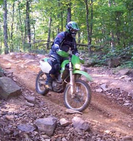
Other Fun Outdoor Activities: Day Hiking, picnicking and horse riding. Area has accessible horse spur location next to ADA toilet area. Gravel parking for 30 horse trail rigs. |
|
| Contact, Directrions & GPS Location |
USDA Forest Service, Conasauga Ranger District office - Phone: 706-695-6736 Address: 3941 Highway 76, Chatsworth, GA 30705
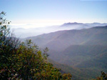
The Conasauga Ranger District covers the western third of the Chattahoochee National Forest. A diverse set of landscapes make up the Conasauga district, from the ridges and valleys west of Interstate 75 to the Cohutta Mountains northeast of Chatsworh, GA. This part of the forest offers some of the best scenery and outdoor recreational activities in north Georgia.
Chattahoochee-Oconee National Forests - Phone: 770 297-3000
Address: 1755 Cleveland Highway, Gainesville, GA 30501
Office hours: Tuesday - Friday at 9 - 12 & 1-4 - Closed Saturday, Sunday, and Monday
Directions to Dry Creek Equestrian Trailhead: Take Exit 320 on I-75; follow State Highway 136 west about 14 miles to Villanow, Ga. At the intersection with Highway 201, turn left onto East Armuchee Road (County Road 705) and go about 7 miles. Just past the signed Manning Mill Road, turn left onto Forest Road 226 and follow the signs to the Dry Creek Trailhead.
Dry Creek Equestrian Trailhead GPS Location: Latitude at 34.578320 and Longitude at -85.130080. |
|
| |
|
Georgia US Forest Areas
 Camping Hiking Camping Hiking
Horseback Riding Trails
FishingCanoe Trails
GA US Forest Wilderness
Wilderness Preparation
Canoe Safety Tips
Forest Safety Tips
GA U S Forest History
|