

|
|
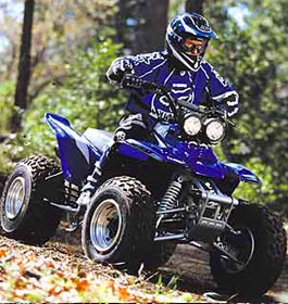
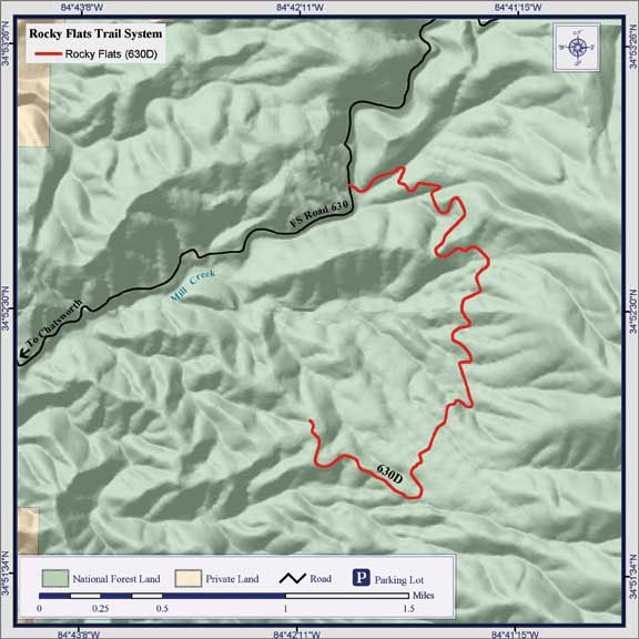
This 3.4 mile trail is suitable for ORVs, ATVs, mountain bikes and hiking. It offers a challenging and safe riding experience with many sharp curves. |
| Rocky Flats OHV Trails - General Information |
OHV Trail Riding - This 3.4 mile trail is suitable for ORVs, ATVs, 4-wheel drive vehicles, mountain bikes and hiking. It follows a multi-purpose woods road over piney rides and through hollows of oak and yellow poplar forest. View timber stands in various states of development. Openings in the forest canopy offer vistas of grassy Mountain. A fee is required to ride on this trail system. About 2.8 miles of the road on the eastern side is open to mixed traffic. Trail also utilized for Mountain Biking and Day Hiking. The closest town is Chatsworth, GA.
Note: Due to a flood-damaged sinkhole at the gate, Rocky Flats is currently closed. Will notify you here when it is re-opened.
There is no charge to ride on this trail system.
Helmets are required for motorbikes by State law. Children under 16 must be accompanied by a licensed driver. The consumption of alcohol while operating any type of vehicle is strictly prohibited according to State and Federal law.
Also used for Mountain Biking and Day Hiking.
OHV Length: 3.4 miles
- Open: Open daily all year. No water or restroom facilities |
|
| Contact & Directions |
 USDA Forest Service, Conasauga Ranger District office - Phone: 706-695-6736 Address: 3941 Highway 76, Chatsworth, GA 30705 USDA Forest Service, Conasauga Ranger District office - Phone: 706-695-6736 Address: 3941 Highway 76, Chatsworth, GA 30705
The Conasauga Ranger District covers the western third of the Chattahoochee National Forest. A diverse set of landscapes make up the Conasauga district, from the ridges and valleys west of Interstate 75 to the Cohutta Mountains northeast of Chatsworh, GA. This part of the forest offers some of the best scenery and outdoor recreational activities in north Georgia.
Chattahoochee-Oconee National Forests - Phone: 770 297-3000 - Address: 1755 Cleveland Highway, Gainesville, GA 30501 - Office hours: Tuesday - Friday at 9 - 12 & 1-4 - Closed Saturday, Sunday, and Monday
Directions: Take US 411 north from Chatsworth about 6 miles. Turn right on Grassy Street and proceed across the railroad tracks to the T-intersection. Turn right, go about 300 feet and turn left onto Forest service Road 630. Travel about 4 miles to 2nd Rocky Flats Road sign and turn right. Limited parking available across the creek.
Directions From Crandall, GA: Go east on Mill Creek Rd, FS 630, about 4 miles to Rocky Flats. |

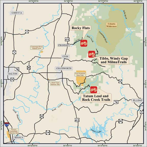
Multiple ORVs Vicinity Map |
|

Multiple ORVs Vicinity Map |
| |
|

More GA US Forest Areas
 Camping Camping  Hiking Hiking
 Horseback Riding Trails Horseback Riding Trails
 Fishing Fishing Canoe Trails Canoe Trails
 GA US Forest Wilderness GA US Forest Wilderness
 Wilderness Preparation Wilderness Preparation
 Canoe Safety Tips Canoe Safety Tips
 Forest Safety Tips Forest Safety Tips
 GA U S Forest History GA U S Forest History
|


