|
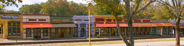
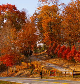
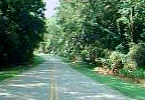
From the Golden Isles to the Chattahoochee National Forest, and small-town main streets to the Atlanta skyline, GA has a remarkably diverse scenic heritage woven together by an extensive system of roads and highways. Click on driving tour name for pictures and info. |
Altamaha Scenic Driving Tour
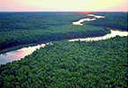
The Byway passes Fort King George, Butler Island and Hofwyl-Broadfield Plantations, the Darien waterfront, sweeping marsh views, and majestic Live Oaks draped with Spanish Moss. Explore both the rich cultural heritage and the diverse marsh ecosystems found along Georgia's coast. |
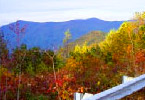
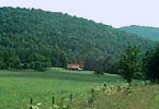
Cohutta-Chattahoochee Scenic Driving Tour
This 54-mile route skirts the town of Chatsworth before traveling up State Route 52, passing Fort Mountain State Park and ending at a scenic mountaintop overlook.
|
|
Historic Piedmont Scenic Driving Tour
Traveling through Putnam and Hancock Counties, the Historic Piedmont Scenic Byway stretches for 82 miles, following State Highways 15, 16 and 77, and rural county roads which link the county seats of Eatonton, Sparta and the communities of Linton, Culverton, and Jewell.
|
|
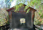
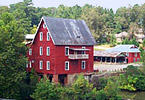
Meriwether-Pike Scenic Driving Tour
The Meriwether-Pike County Scenic Byway offers several attractions including the Red Oak Covered Bridge, the Oakland Baptist Church, and Jones Mill, where a large grist mill and mill pond are the only reminders of a once-thriving farm community.
|

Monticello Crossroads Scenic Driving Tour
Native Americans and evangelical Methodist Circuit Riders once used these routes as they crossed the state. Highway 83 was also part of the Seven Island Stage Coach Road that ran from Augusta to New Orleans and the Natchez Trace.
|
|
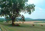
Ridge Valley Scenic Driving Tour
This Scenic Byway provides a chance to experience the varied terrain of northwest Georgia. Mountain overlooks and fertile farmlands can be found along the 51-mile Byway as it travels U.S. 27, State Highways 156 and 136, and rural county roads.
|
|
 Russell Brasstown Scenic Driving Tour Russell Brasstown Scenic Driving Tour
Located within the Chattahoochee National Forest in northeast Georgia, the Russell Brasstown Scenic Byway is a 41-mile loop revealing some of the most dramatic scenery in the state. Included on this route is Brasstown Bald, Georgia's highest mountain.
More pictures, information and map. |
 South Fulton Scenic Driving Tour South Fulton Scenic Driving Tour
This 29-mile loop in south Fulton County highlights the rural character and lifestyle of the surrounding area. Situated among rolling hills, forested ridges, and serene pastures, the South Fulton Scenic Byway uses Cochran Mill Road, Hutcheson Ferry Road and State Hwy 70 to guide visitors through this quiet corner of metropolitan Atlanta.
|
|