


|
|
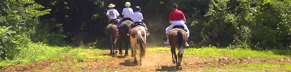
Georgia has abundant WMAs, State Parks and Chattahoochee-Oconee National Forests scenic horseback riding locations. Use any multi-user trails, hunters or roads shared with motor vehicles with extreme caution. Click on blue links for more info. |
| Local Parks |
| Garland Mountain Horse & Hiking Trails - Amenities: 6.5 miles of trails. Construction of the remaining 6.9 miles of the trails begun in January 2010. Phone: 770-924-7768 - Address: 1411 Garland Mountain Way, Waleska, Georgia 30183 |
| Georgia International Horse Park - The more than 15 miles of horse trails at the Park offer scenic views of the former Olympic Endurance Course, and wind through wooded areas blended with open pastureland and streams. Varied trail lengths and links between trails allow you to choose your route and tailor your ride. The course is open for public riding and organized group trail rides. Trails are a great way to enjoy a day of trail riding and explore the natural beauty of the park. Please note that you must bring your own horse. We do not stable horses for rental on trails. A large map of the trails is posted at each trail shelter as well as individual maps for you to take on your ride. Trails are open from daylight to dusk. On occasion, trails may be closed due to other events occurring at the Park. Please make sure you check the calendar of events on this website for dates the trails are closed. There is no fee to ride the trails. |
Harbins Park - Phone: 770-822-5414 - Trails Hotline: 770-978-5270
Address: 2995 Luke Edward Road, Dacula, Georgia 30019
Park Hours: Sunrise until sunset unless posted otherwise.
Park Amenities: 1795 acres. 4.35 mile pavied multi-purpose trailhoops. Miles of soft surface trails that include a 7-mile equestrian trail, 7-mile mountain biking trail and 4.5-mile hiking trail. Park also features a tri-level playground, large rustic pavilion, equestrian-only parking area and restrooms. |
Little Mulberry Park - Phone: Program & Rentals: 770-614-2060 - Trail Info: 770-978-5270
3 Entrances to Park : 3855 Fence Road, Auburn, Georgia 30011 - 3900 Hog Mountain Rd., Dacula, Georgia 30019 and 1300 Mineral Springs Rd., Dacula, Georgia 30019
Park Hours: Sunrise until 11 pm unless posted otherwise
Park Amenities: 890 Acres - 5 miles of trails of paved multi-purpose and soft-surface trails for equestrian and hiking. An additional parking lot, for equestrian use only, is located on the side of the park that faces Mineral Springs Road. Handicap-accessible trail around a pond, and over 2 miles of woodland foot trails. Other amenities include a large rustic picnic pavilion, two smaller picnic pavilions, restrooms, playground, grill, and an observation terrace at the peak of the West Meadow that is one of the highest elevations in Gwinnett Co.
Hog Mountain entrance includes the 200-acre Karina Miller Nature Preserve, additional trails including those designed for equestrian use, a connector trail to the rest of the park on the Fence Road side, a lake with several fishing piers.Little Mulberry Park is the second largest park owned by Gwinnett County. |
McIntosh Reserve – Amenities: The Reserve is 527 acres packed with history, trails, a splash water park, pavilions and sweeping frontage on the Chattahoochee River. The park is a favorite of hikers and equestrian riders.
Park Hours, Guidelines & Contact Phone Number
McIntosh Reserve Park is open year round except for Thanksgiving Day, Christmas Day, and New Years Day. Park office hours are 8 am until 5 pm daily. Park hours are 8 am until 8 pm (Summer) and 8 am until 7 pm (Winter). Camping and Pavilion reservations may be made by phone or in person M-F from 8 am until 5 pm. Picnic shelters and camp sites are available daily by reservation or without reservations if you are in the Park before closing time. Picnic tables not occupied by campers are available on a first come first serve basis. Quiet time for campers begins at 10 pm and continues until 7 am. Pets are allowed, but must be in control of the owner at all times. Dogs should be on leashes at all times. Horses should be not be tied to individual trees which could result in damage to the tree. Phone: 770-830-5879
Driving Directions: McIntosh Reserve Park is located 35 miles southwest of Atlanta along the Chattahoochee River and can be reached via U.S. Alt. 27 from Carrollton or Newnan and GA Hwy. 5 from Douglasville. Direct access to the park is provided by a county-maintained road that connects with GA 5 two miles west of Whitesburg, Georgia |
|
Tribble Mill Park - Phone: Info & Rentals: 770-822-5414 - Trails Hotline: 770-978-5270
Address: 2125 Tribble Mill Parkway, Lawrenceville, Georgia 30045
Park Hours: Sunrise to sunset unless posted otherwise
Park Amenities: 700 Acres - 2 lakes, 108-acre recreation lake and a 40-acre fishing lake (non-motorized boats allowed). A generous open space named Ozora Meadows that accommodates up to 3500 people for large events. Ozora Meadows has a large handicap-accessible playground, pavilion, an outdoor amphitheater area, restrooms, and water and electricity connections. Also has lakeside pavilions, 3.4 miles of paved multi-purpose trails, soft-surface trails for horseback riding and mountain biking. Also has playground, grill and restrooms. |
| Wildwood Park - Amenities: 975 Acres. Wildwood Park is open year round for camping and family outings. 61 Campsites, 2-12 miles of horse riding trails, 8 boat ramps (6-mega Ramp System), Beach Area, PIcnic Area, 4 Covered Pavilions, and future home of National Disc Golf Headquarters & Hall of Fame. Phone: 706-863-7523 - Address: 6212 Holloway Road, Appling, Georgia 30802 - Located on Clarks Hill Lake. From I-20 exit 183 onto GA 47/US 221. Go approximately 3 miles into Appling, Hwy 221 will bear to right, follow to intersection at Pollard's Corner, Approximately 5 miles. Turn left onto Washington Rd. (SR #47), go approximately 3 miles. Park entrance will be on right at Holloway Rd. |
Yellow River Park - Phone: Info & Rentals: 770-978-5271 - Trails: 770-978-5270
Address: 3232 Juhan Road, Stone Mountain, Georgia 30058
Park Hours: Sunrise to sunset unless posted otherwise
Park Amenities: 566 Acres - Beautiful forests and wildflowers, and one of the best places to enjoy both is Yellow River Park in the southern tip of the county. This park is mostly wooded and contains several different types of forests. The wooded area covering the majority of the park mainly consists of upland deciduous forests, traditional pine woodlands, and mixed pine and hardwood forests. The park includes 12 miles of winding mountain bike, hiking and horse trails through the woods above the Yellow River. Bike trails range from flat, smooth and wide for beginner cyclists to twisty, rocky and steep single-track trails coveted by more advanced cyclists. It also has a 1-mile paved multi-purpose trail, equestrian trailer parking, grill and restrooms. |
|
| Chattahoochee-Oconee National Forests - NOTE: Use any multi-use trails and roads shared with motor vehicles and hikers with extreme caution. |
Cohutta Wilderness Trailheads -
Phone: 706 695-6736 - Conasauga District Ranger Office,
3941 Highway 76, Chatsworth, Georgia 30705 - Office hours: Monday - Friday 8 am - 12 noon and 1-4:30 pm. The Conasauga Ranger District covers the western third of the Chattahoochee National Forest. A diverse set of landscapes make up the Conasauga district, from the ridges and valleys west of Interstate 75 to the Cohutta Mountains northeast of Chatsworh, GA. This part of the forest offers some of the best scenery and outdoor recreational activities in north Georgia.
Trail Features: 3 - Forks & Betty Gap Trailhead. Some trails open to horses. 11 Trailheads.
There is no fee riding in these trails. |
| Dry Creek Equestrian Trailhead - Enjoy 26 scenic miles of U.S. forest hiking, mountain biking and horseback riding awsomeness. |
| Iron Mountain Trail - Bike Trail: 12 mile trail suitable for Mountain Bikes, Hiking and Horseback Riding. Horse camping available adjacent to trialhead for $8 per night. Beginning at the Cottonwood Patch camping area, the trail fords the Conasauga River and passes through grassy wildlife clearings as it gradually ascends to a forest opening for a spectacular view of the rugged Cohutta Mountains. The trail continues over rolling terrain to its end on Forest Service Road 1. Free of charge. Contact Info : 706 695-6736 - Conasauga District Ranger Office, 3941 Highway 76, Chatsworth, Georgia 30705 - Hours: Monday - Friday 8 am - 12 noon and 1-4:30 pm. Directions: Take U.S. 411 north from Chatsworth and go 12.3 miles to Cisco. Turn right onto Old GA 2 and proceed 8.1 miles to the trailhead in the Cottonwood Patch camping area. |
| Jake and Bull Mountain Trail in Dahlonega - This Trail System provides around 36 miles of recreational trails for equestrians, bicyclists and hikers. The system is made up of interconnecting dirt trails and gravel roads which are accessed by two trailheads. Elevations range from 1,700 to 2,500 feet. |
|
| Ocumlgee Bluff Horse, Bike and Hike Trail System - It is the jumping off point for the 30-mile Ocmulgee River Horse, Bike and Hiking Trail. This area has parking for a large number of vehicles and horse trailers and can accomodate large groups of riders. |
| Pinhoti Trail in Georgia - Bike Trail: The Pinhoti Trail is one of the Southern Appalachian Mountain's premier long distance hiking trails, offering over 160 miles of recreation opportunities for hikers, backpackers, horse-riders, and mountain bikers in Georgia. |
| Upper Chattahoochee River Campground -
High in the north Georgia mountains and far from civilization, this recreation area offers camping, picnicking, hiking, and fishing along the headwaters of the Chattahoochee River. The Chattahoochee River Recreation Area has toilets accessible to people with disabilities. Drinking water is available. Accessible campsites are available at this area. A campground host resides here during a portion of the season. The Appalachian Trail is nearby, as well as Horse Trough Falls and the Mark Trail Wilderness Area. |
| Willis Knob Horse Campground - Located in the North Georgia Mountains, and far from civilization, lies one of the Chattahoochee-Oconee National Forest’s most beloved horse-lover hideaways: Willis Knob Campground. The campground features camping for horseback riders, riding and hiking trails, and fishing in the nearby Chattooga River. Restrooms are accessible to people with disabilities. The Willis Knob Trail in Georgia combines with South Carolina's Whetstone Horse Trail to offer 27.5 miles of the most scenic horseback riding and hiking in the Southern Blue Ridge Mountains. Winding across deeply dissected ridges, the trails descend into the beautiful Chattooga Wild and Scenic River.Horse camps and horse trails are available at this recreation area near the South Carolina state line. Rugged mountain scenery over trail that descends into the Chattooga River basin. Camping, fishing, hiking, and horse trails. This trail provides some of the most scenic horseback riding opportunities in the Southeast. |
|
| Wildlife Management Areas for Horseback Riding Region 1 - Phone 706-295-6041 |
| Cohutta WMA - Trail Features: 95,200 acres. Horseback Riding, Hunting, Camping, Fishing, Firearms Shooting Range, Field Trail Access, Hiking, Bird Watching, Picnicking, Observation Tower - Located 15 miles northwest of Ellijay, Georgia |
| Crockford-Pigeon Mountain WMA - Trail Features: 16,400 acres. Horseback Riding, Hunting, Camping, Fishing, Interpretive Trail, Hiking, Bird Watching, Field Trail Access, Picnicking - Located 5 miles southwest of Lafayette, Georgia |
| John's Mountain WMA - Trail Features: 24,000 acres. Horseback Riding , Hunting, Camping, Fishing, Firearms Shooting Range, Field Trail Access, Hiking, Bird Watching, Picnicking and Observation Tower - Located 12 miles northeast of Calhoun, Georgia |
| Rich Mountain WMA - Trail Features: 22,000 acres. Horseback Riding, Hunting, Camping, Fishing, Archery Range, Field Trail Access, Canoe Access, Hiking, Bird Watching, Picnicking - Located 11 miles northwest of Ellijay, Georgia |
| Region 2 - Phone 770-535-5700 |
| Blue Ridge WMA - Trail Features: 38,900 acres. Horseback Riding, Hunting, Camping, Interpretive Trail, Fishing, Hiking, Bird Watching, Picnicking - Located 10 miles north of Dahlonega, Georgia |
| Lake Russell WMA - Trail Features: 17,300 acres. Horseback Riding, Hunting, Camping, Fishing, Hiking, Bird Watching, Picnicking - Located 6 miles southwest of Toccoa, Georgia |
| Region 3 - Phone 706-595-4222 |
| Di-Lane WMA - Trail Features: 8100 acres. Horseback Riding, Hunting, Camping, Interpretive Trail, Fishing, Hiking, Bird Watching, Field Trail Access - Located 10 miles south of Waynesboro, Georgia |
| Redlands WMA - Trail Features: 37,500 acres. Horseback Riding, Hunting, Camping, Archery Range and Firearms Shooting Range, Observation Tower, Boat Ramp, Canoe Access, Fishing, Hiking, Bird Watching, Picnicking - Located 4 miles north of Greensboro, Georgia |
| Yuchi WMA - Trail Features: 7800 acres. Horseback Riding, Hunting, Camping, Firearms Shooting Range, Boat Ramp, Canoe Access, Fishing, Hiking, Bird Watching - Located 15 miles southeast of Waynesboro, Georgia |
| Region 4 - Phone 478-825-6354 |
| Charlie Elliott Wildlife Center - Trail Features: 6400 acres. Horseback Riding, Hunting, Camping, Fishing, Firearms Shooting Range, Boat Ramp, Canoe Access, Interpretive Trail, Hiking, Bird Watching, Field Trail Access, Picnicking - Located 3 miles south of Mansfield, Georgia |
| Region 5 - Phone 229-430-4254 |
| Albany Nursery (Lawrence Pearce) - 229-430-4256 - Trail Features: Horseback Riding, Hunting, Interpretive Trail, Bird Watching, Field Trail Access, Canoe Access - Located 10 miles west of Albany, Georgia |
| Flint River WMA - 229-430-4254 - Trail Features: 2300 acres. Horseback Riding, Hunting, Fishing, Hiking, Bird Watching - Located 10 miles south of Montezuma, Georgia |
| Hannahatchee Creek WMA - 229-430-4254 - Trail Features: 5600 acres. Horseback Riding, Hunting, Camping, Firearms Shooting Range, Hiking, Bird Watching - Located 5 miles northwest of Richland, Georgia |
| Mayhaw WMA - Trail Features: 4700 acres. Horseback Riding, Hunting, Camping, Firearms Shooting Range, Hiking, Bird Watching - Located 3 miles northwest of Colquitt, Georgia |
| Region 6 - Phone 229-426-5267 |
| Tuckahoe WMA - Trail Features: 15,100 acres. Horseback Riding, Hunting, Camping, Boat Ramp, Canoe Access, Fishing, Bird Watching - Located 10 miles east of Sylvania, Georgia |
| State Parks - All parks charge $5 parking fee. - Click on park names for more info. |
A. H. Stephens State Historic Park - 456 Alexander St., Crawfordville, Georgia 30631
12 miles of horseback riding trails. |
| F. D. Roosevelt State Park - 2970 GA Hwy. 190, Pine Mountain, Georgia 31822
- Park has horseback riding stables, horse rentals and 20 miles of horseback riding trails. |
Fort Mountain State Park - 181 Fort Mountain Park Road, Chatsworth, Georgia 30705
Park has 25 miles horseback riding trails. |
| Hard Labor Creek State Park - 5 Hard Labor Creek Road, Rutledge, GA 30663 - Park has 22 miles horseback riding trails. |
| Watson Mill Bridge State Park - 650 Watson Mill Rd., Comer, Georgia 30629 - Park has 12 miles horseback riding trails. |
|
| |
|

|