


|
| Click on the names below for more info and pictures. Please note these areas may close temporarily due to bad weather. Call before visiting to see if location is open. |
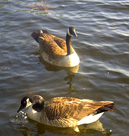
| Andrews Cove Campground offers a cool mountain stream and a peaceful atmosphere, and is only 15 minutes from the popular alpine village of Helen.
This recreation area offers restrooms and camp sites equipped with tent pads, picnic tables, grills, and lantern posts. The Andrews Cove Trail follows an old logging road parallel to Andrews Creek. This trail is 2 miles long and provides access to the Appalachian Trail and Forest Service Road 283 at Indian Grave Gap. Loop through recreation area is paved. Fish for trout in Andrews Creek here. |
| Boggs Creek Recreation Area - Located approximately 30 minutes from historical downtown Dahlonega, GA, Boggs Creek Recreational Area offers over 30 individual campsites under the cover of pine, hemlock and poplar trees and is spread out along two winding miles of the beautiful Boggs Creek. Whether you’re visiting for the day with a couple of friends to take advantage of the seasonal fishing opportunities or camping with the whole family, Boggs Creek offers a rich, yet primitive outdoor experience. |
| Cooper Creek Recreation Area -
Located along the banks of Cooper Creek and far from civilization, this area offers camping, hiking and trout fishing. There are 17 camp sites. Four of the sites are waterfront. Hikers can enjoy the Yellow Mountain Trail, Mill Shoals Trail, and the Cooper Creek Trail. Fishing in Cooper Creek and in Mulky Creek for stocked and wild trout is popular. Cooper Creek Scenic Area joins the recreation area and features 1,240 acres with hiking trails and fishing more tributaries of Cooper Creek. |
| Deep Hole Recreation Area -
Located along the banks of the Toccoa River, this recreation area offers camping, boating and fishing. The 8 campsites are equipped with tent pads and picnic tables. The canoe launch makes river access very easy. Floating down the Toccoa River is very popular. Fishing for rock and smallmouth bass, rainbow and brown trout. Deep Hole Recreation Area has toilets and drinking water. Restrooms and some campsites are accessible to people with disabilities; path to canoe launch and fishing deck is also accessible. |
| Dockery Lake Recreation Area -
Overlooking Dockery Lake and nestled deep off the side of a mountain, this recreation area offers camping, hiking, picnicking and fishing. Hikers can enjoy the 3.4-mile Dockery Lake Trail, which provides access to the Appalachian Trail. Fishing in Dockery Lake is popular also. The picnic area offers six picnic tables. Lake Winfield Scott Recreation Area offers similar recreation opportunities and is located to the south of Dockery Lake. Dockery Gap Scenic Overlook offers another spectacular view of north Georgia, and Woody Gap offers a breathtaking view as well. The Appalachian Trail also can be accessed at Woody Gap. |
|
| Frank Gross Recreation Area -
Located along the banks of Rock Creek and far from civilization, this area offers camping, hiking and trout fishing. There are nine campsites with picnic tables, tent pads and grills. Hikers can enjoy the Appalachian Trail nearby and it can be accessed easily from Forest Service Road 69. Another beautiful hike is along the Benton MacKaye Trail to the north of Frank Gross; this trail crosses the Toccoa River on a suspension bridge that is 260 feet long. Fishing in Rock Creek and Mill Creek for stocked and wild trout is popular. |
| Hickory Gap Campground - Seated alongside the sparkling Mill Creek trout stream, and just east of the community of Crandall, GA, is a beautiful gem of a campground named after the Hickey family who once lived there. |
| Jacks River Fields Campground - This quaint, secluded campground is situated on the bank of the south fork of the Jacks River. Surrounded by a northern hardwood forest in north Georgia, these 7 campsites are popular with campers, hikers and equestrians. |
| Lake Conasauga Recreation Area - This beautiful 19-acre spring-fed lake resting near Grassy Mountain is the highest lake and campground in Georgia. Families will enjoy camping in this quiet, rustic setting which offers cool summertime temperatures. Whether hiking to the Songbird Management area or to Grassy Mountain tower, fishing, or swimming, you will revel in this area rich in plants, birds and wildlife. |
| Lake Rabun Beach Recreation Area - Cradled in the hills of the North Georgia Mountains overlooking beautiful Lake Rabun, this developed recreation area offers camping, hiking, all sorts of water activities like swimming, boating and fishing, and an opportunity to absorb the peaceful lake scenery. There are 80 tent and trailer campsites in this family-oriented setting that will easily transform whatever gear you have into an outdoor home away from home. |
| Lake Russell Recreation Area - On the peaceful shore of the 100-acre Lake Russell, this fun recreation area offers 42 campsites that accommodate both tent and RV camping. A picnic shelter for 30 is available on a first come first serve basis. It has a large grass-covered beach and swimming area. 2 paved campground loop roads offer easy access to all that this outdoor mecca has to offer. Other fun activities include hiking, biking, fishing, horseback riding, and boating (non-motorized/electric watercraft only), this scenic getaway is sure to become an outdoor destination for the entire family! |
| Lake Winfield Scott Campground -
Overlooking beautiful 18-acre Lake Winfield Scott in the north Georgia mountains, this recreation area offers camping, picnicking, boating, fishing and hiking. Hikers can enjoy numerous trails near this area, including the Lake Winfield Scott Trail, the Jarrard Gap Trail, the Slaughter Creek Trail, and the Appalachian Trail. Fishing, swimming and boating (electric motors only) in the clear 18-acre lake are popular also. A paved boat launch is located near the head of the lake. Loop through recreation area is paved. The area has a few campsites that are accessible to disabled visitors, and has an accessible fishing deck. |
|
| Low Gap Campground - Located within the Chattahoochee Wildlife Management Area and veiled by the Mark Trail Wilderness, this 13-site developed campground is as close as it gets to a dispersed camping experience with amenities. This clandestine campground is best known for its plethora of opportunities in camping, fishing, hiking, hunting, and simply basking in the light of the natural world. Low Gap is another one of our campgrounds located only a few miles from Georgia's much loved vacation destination, the alpine village of Helen, Georgia. |
| Morganton Point Campground - Overlooking beautiful Lake Blue Ridge in the north Georgia mountains, this recreation area has it all! This area offers 37 campsites, and picnickers have 13 picnic tables and a shelter to enjoy. A paved boat launch has two ramps and is located near the campground. Hikers can enjoy a scenic trail that parallels the lake shore. Fishing and swimming in the clear 3,290-acre lake is popular also. Loop through the recreation area is paved. Area has a few campsites that are accessible to people with disabilities, and has one accessible restroom. |
| Mulky Campground -
On the beautiful Cooper Creek, this recreation area offers camping, hiking and fishing. The camping area is across the road from the creek, with picnic tables and grills. Hikers enjoy the Yellow Mountain Trail, Mill Shoals Trail, and the Cooper Creek Trails. Fishing in Cooper Creek and in Mulky Creek for stocked and wild trout is popular. Cooper Creek Scenic Area joins Cooper Creek Recreation Area and features 1,240 acres with hiking trails and fishing more tributaries of Cooper Creek. Good, hard-surface roads until you reach Forest Service Road 4; this is a gravel road and is crooked and steep in parts. Facility is accessible for the disabled; campsites are all on flat ground and restrooms are accessible. |
| Oconee River Campground -
Located along the bank of the Oconee river, this recreation area offers camping, picnicking, hiking, boating and fishing. Hikers can enjoy the Scull Shoals Trail, which is 1 mile and originates at this area. The picnic area is located near the area entrance and has six picnic tables. The boat launch is located at the end of the main area road. Fishing for bass, crappie, bream and catfish is popular among visitors. Check State fishing regulations before fishing. Main road through campground is paved. Some of the campsites are accessible to people with disabilities, as are the restrooms. Drinking water is available. |
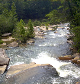
| Sandy Bottoms Campground -
Rugged mountain scenery and the Tallulah River plunging by make this a beautiful place to camp, fish or hike. The area offers 12 camp sites with picnic tables, grills and tent pads. The Tallulah River offers good trout fishing. Hiking through nearby Coleman River Scenic Area is popular. The Coleman River Trail parallels the river for 1 mile through stands of large old-growth timber. Drinking water is available. |
|
| Sarah's Creek Campground - Extending the same primitive feel as its neighboring Warwoman Wildlife Management Area (WMA) and the Chattooga Wild & Scenic River, Sarah's Creek 26-site developed campground offers a tranquil escape, a place to relax and even catch a few fish. |
| Tallulah River Campground -
Rugged mountain scenery and the Tallulah River plunging by make this a beautiful place to camp, fish or hike. This campground is at an elevation of 2,080 feet, in the foothills of the Blue Ridge Mountains in NE Georgia. Visitors will find it complete with restrooms, picnic tables, grilles, camping pads in this scenic river area. |
|
Tate Branch Campground -
Located at the junction of the Tallulah River and Tate Branch, this recreation area offers camping and fishing. This remote area offers 19 camp sites with tent pads, picnic tables and grills. Trout fishing is good along the Tallulah River and Tate Branch. Hiking through nearby Coleman River Scenic Area is popular. The Coleman River Trail parallels the river for 1 mile through stands of large old-growth timber. Campsites are equipped with a tent pad, picnic table and grill. Drinking water available. |
| Upper Chattahoochee River Campground -
High in the north Georgia mountains and far from civilization, this recreation area offers camping, picnicking, hiking, and fishing along the headwaters of the Chattahoochee River. The Chattahoochee River Recreation Area has toilets accessible to people with disabilities. Drinking water is available. Accessible campsites are available at this area. A campground host resides here during a portion of the season. The Appalachian Trail is nearby, as well as Horse Trough Falls and the Mark Trail Wilderness Area. |
| Willis Knob Horse Campground - Located in the North Georgia Mountains, and far from civilization, lies one of the Chattahoochee-Oconee National Forest’s most beloved horse-lover hideaways: Willis Knob Campground. The campground features camping for horseback riders, riding and hiking trails, and fishing in the nearby Chattooga River. Restrooms are accessible to people with disabilities. The Willis Knob Trail in Georgia combines with South Carolina's Whetstone Horse Trail to offer 27.5 miles of the most scenic horseback riding and hiking in the Southern Blue Ridge Mountains. Winding across deeply dissected ridges, the trails descend into the beautiful Chattooga Wild and Scenic River. Trails nearby open to hiking only are the 10.7-mile Chattooga River Trail and the 37-mile Bartram Trail. |
|
|
|
More GA US Forest Areas
 Camping Hiking Camping Hiking
Horseback Riding Trails
FishingCanoe Trails
GA US Forest Wilderness
Wilderness Preparation
Canoe Safety Tips
Forest Safety Tips
GA U S Forest History
|