Lake Sidney Lanier Parks Rules and Regulations - The Corps of Engineers, in conjunction with the Georgia Department of Natural Resources actively manages fish habitat on Lake Lanier.
Play and Stay in GA!
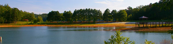
General Info: Over 7.5 million people a year visit Lanier. With over 690 miles of shoreline and over 100 small islands Lake Lanier is the perfect place to pursue your recreational adventure. Recreation includes fishing, camping, boating, picnicking, swimming or a variety of other activities.
Contact Numbers: Water Release Schedules 770-945-1466 - Lake Info 770-945-1467 and
Corps of Engineers 770-945-9531
Directions to Lake Lanier Visitor Center: From I-985/Buford Take GA Hwy 20 West, from GA 400/Cumming, take GA Hwy 20 East, to North on Suwanee Dam Road. Go 3 miles and go left on Buford Dam Road. The Visitor Center is one mile down on the right. Make reservations at 1-877-444-6777.
Lake Lanier Fishing and Waterfowl Hunting
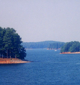
Lake Lanier is well known as a productive fishing lake. Many species of fish thrive in the lake. The lake has approximately 39,000 surface acres of water at its full level. Although there is little natural cover in the top 1/3 of the lake due to tree clearing during construction, there are trees left standing in the lower portions of the lake as well as brush piles, drop-offs, submerged humps, and rock outcroppings in shallower areas. A navigation map will be helpful for finding these spots and is available in the map room.
The Corps of Engineers, in conjunction with the Georgia Department of Natural Resources actively manages fish habitat on Lake Lanier. Each year volunteers help build and maintain fish attractors around the lake. Information about fish attractor structures may be obtained the map room.
Trout fishing below Buford Dam is also popular.
The cold waters released from the bottom of the lake support rainbow, brown and brook trout that are stocked in the river by the GA DNR. Fishing is permitted year-round. However, fishermen must use extreme caution when fishing below the dam and abide by special safety regulations.
Waterfowl hunting is permitted on Lake Lanier in accordance with state and federal regulations. Due to limited public land surrounding the lake and intensive residential development, no other hunting is allowed.
Picnicking at Lake Lanier
Lake Lanier has hundreds of picnic sites with beautiful views of the lake and surrounding woodlands. Most sites have boat ramps and convenient access to restrooms. Group picnic shelters are available at several parks. These are a perfect setting for a family reunion, birthday party or company picnic. Most shelters will accommodate up to 100 people and all have tables, a large grill as well as electric outlets and lights.
Reservations for Corps of Engineers operated shelters may be made by calling our office. Call for fees. Larger groups of up to 3,000 people can be accommodated at Lake Lanier Islands Park. Contact the park at 770-932-7200.
Swimming at Lake Lanier
Wade the shoreline, float on a raft or make a big splash in the cool, clear waters of Lake Lanier. The Corps of Engineers operates 20 swimming areas around the lake. All Corps of Engineers operated swimming areas are “swim at your own risk’. No lifeguards are on duty. The Corps recommends swimming at designated swim areas only. View the list of all Corps swim areas.
For more excitement, visit the Lake Lanier Islands Beach and Water Park. There you will find water slides, wave pools and a variety of other water attractions.
Hiking at Lake Lanier
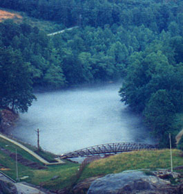
Hikers may want to visit the Laurel Ridge Trail located near Buford Dam. Along the 3.8-mile trail you can glimpse beautiful views of the lake, woodland and river scenery, as well as rare wildflowers and a variety of wildlife. The trail winds through several park areas, along the lake’s shoreline and the banks of the Chattahoochee River. View a map of the trail from the map room or see a video.
You may also want to visit the newly constructed Little Ridge Trail. The trail is 1.05 miles long and features a number of different wildlife viewing opportunities.
Lake Lanier Reservations and Regulations Info
Picnic Shelters are available at several Corps of Engineers operated parks at Lake Sidney Lanier. These shelters are ideal for family reunions, birthday parties or company gatherings.
Reservations for shelters can be made in person at the Lake Lanier Management Office located at Buford Dam or by telephone. The dates picnic shelters are available for reservation are the end of April through early September. Reservation dates and/or locations are not transferable.
Reservation Fees are charged to offset the cost of operating the shelters. Payment may be made by credit card (Visa or MasterCard), personal check or cash. Tentative reservations will not be accepted. All reservation fees are non-refundable. Payment of the reservation fee does not include day use fees at selected parks.
Shelter Capacity is limited to the maximum number of people established for the shelter. The setup of tents or carnival type equipment is not allowed.
Directional Signs placed along park roadways are prohibited.
Parking cannot be guaranteed. Because of Lake Lanier’s popularity your group should plan to arrive before 11 a.m. When parking areas are full, entry to the park may be closed.
Park Open Hours are from 7 a.m. until 10 p.m. The Upper Overlook, Buford Dam, West Bank and Lanier Park gates open at 8 a.m.
Alcoholic Beverages are prohibited in all parks.
Georgia's Beautiful Lake Sidney Lanier - Located in the foothills of the Blue Ridge Mountains in North Georgia is Lake Lanier, one of the most popular lakes in the SE. Lake Lanier is a large reservoir formed from the Chattahoochee River. Buford Dam is at the south end of the lake.