

|
| Toccoa River Sandy Bottoms Recreation Area Camping & General Information |
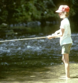
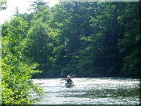
This small campground is along the banks of the Toccoa River near Blue Ridge. This recreation area is the take-out for the 13.8 mile Toccoa River Canoe Trail. Fishing is another favorite activity here.
 Campground Camping: There are 4 camping sites. Amenities include a grill, picnic tables, lantern post, etc. There is 1 vault facility and a canoe take-out onsite. There are no water or electric hook-ups or dump station available in the campground. There is no parking at the campsites, parking is across the road in the day use parking area. Campground Camping: There are 4 camping sites. Amenities include a grill, picnic tables, lantern post, etc. There is 1 vault facility and a canoe take-out onsite. There are no water or electric hook-ups or dump station available in the campground. There is no parking at the campsites, parking is across the road in the day use parking area.
Reservations - Reservations are not required. Occupancy of sites are on a first come, first serve basis.
Fees: Camping - $8 per campsite per night. Day Use fee is $3 per vehicle per day.
Restrictions - 14 day stay limit. Maximum 2 vehicles per campsite. Dogs must be leashed at all times.
Open: All year 24 hours a day. Quiet hours are 10pm until 6am.
Water: No drinking water - Restroom Facilities: 1 Vault facility
Closest Town: The nearest town is around 11 miles north, or 20 minutes, in Blue Ridge, GA. |
|
| |
Passes: The Interagency Senior and Access Passes and the Golden Age and Access Passports are accepted. These passes entitle the pass holder to a 50% discount on camping fees.
Chattahoochee Outdoor Adventures Annual Pass: $50. Available by calling Chattahoochee Outdoor Adventures at 1-800-251-4800.
This Annual Pass is valid at the following recreation areas for day use activities only: Lake Winfield Scott, Morganton Point, DeSoto Falls, Lakewood Landing Boat Launch, Toccoa River Sandy Bottoms, and Deep Hole.
 Operated By: Chattahoochee Outdoor Adventures, INC. under permit by the US Forest Service. Operated By: Chattahoochee Outdoor Adventures, INC. under permit by the US Forest Service.
More Recreation Activities
River and Stream Fishing - Fishing for rock and smallmouth bass, rainbow and brown trout is popular among anglers in the Toccoa River. Check State fishing regulation before fishing www.gofishgeorgia.com.
Day Hiking Trails within a 30 minute drive: The Benton MacKaye Trail crosses Old Dial Road 0.75 miles north of the campground at the intersection of Old Dial Road and Shallowford Bridge Road. The Aska Trail System is approximately 6.0 miles north of the campground and provides approximately 17.0 miles of recreational trails for bicyclists and hikers.
Boating - Non-Motorized: The Toccoa River Canoe Trail starts at the Deep Hole Recreation area and flows 13.8 miles to the take-out at Toccoa River Sandy Bottoms Recreation Area. People floating the Toccoa River are allowed passage through private lands along the river. However, according to state law, fishing, camping and entering onto private land is illegal without landowner permission, as is fishing from the river in a boat, tube, or any other floating device where both sides of the river are privately owned. |
|
| Contact, Directions & GPS Location |
USDA Forest Service, Blue Ridge Ranger District - Phone: 706-745-6928
Address: 2042 Highway 515 West, Blairsville, GA 30512 - Office hours: Monday - Friday at 8-12 & 1-4:30 pm
Directions From Blue Ridge, GA - Go south on Aska Road 8.5 miles. Turn left, go across Shallowford Bridge and turn right on Shallowford Bridge Road. Go 1.3 miles to Old Dial Road. Turn right on Old Dial Road, go 0.6 miles to recreation area.
Toccoa River Sandy Bottoms Recreation Area GPS Location - Latitude is 34.78675 and Longitude is -84.23888 . |
|
| |
|

Georgia US Forest Areas
 Camping Camping  Hiking Hiking
 Horseback Riding Trails Horseback Riding Trails
 Fishing Fishing Canoe Trails Canoe Trails
 GA US Forest Wilderness GA US Forest Wilderness
 Wilderness Preparation Wilderness Preparation
 Canoe Safety Tips Canoe Safety Tips
 Forest Safety Tips Forest Safety Tips
 GA U S Forest History GA U S Forest History

|


